Winnipeg, you have a driving problem
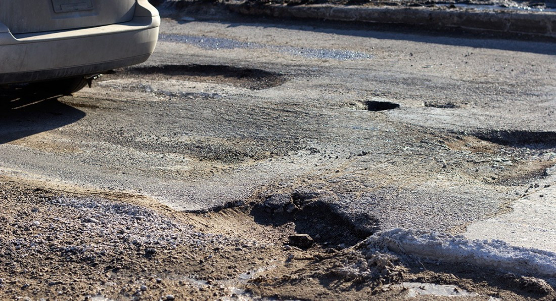
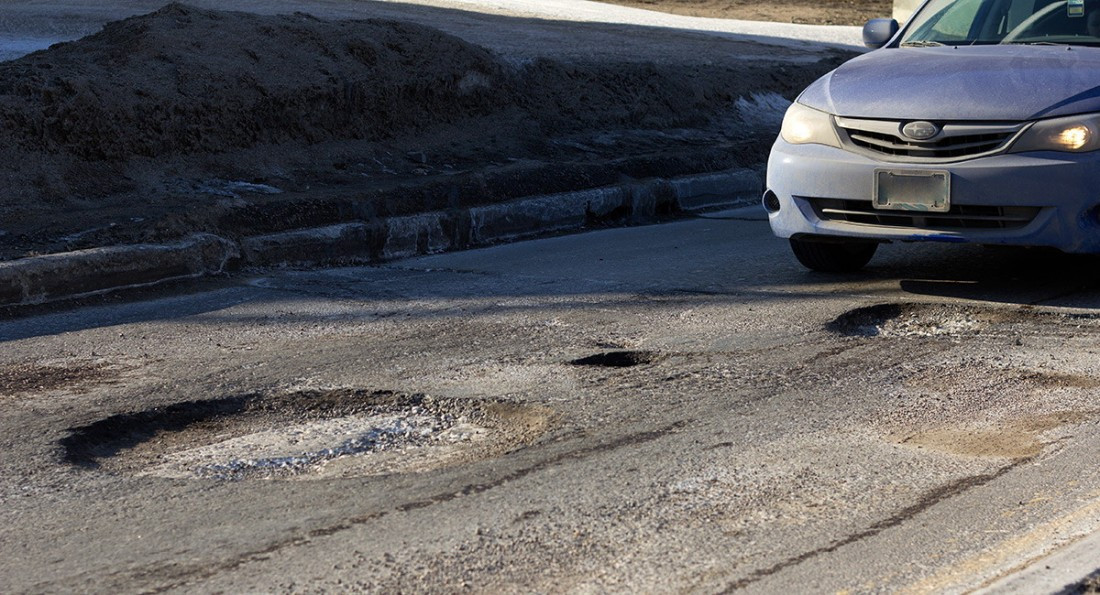
Potholes are symptomatic of deeper problems in the city
“The heart of Winnipeg has a pothole in it." -Charles Adler
Most people in Winnipeg would agree with Mr. Adler. Potholes are a major issue. Ask the average ‘Pegger what’s the most important issue facing the city, and you’re likely to hear “maintaining the infrastructure”, at least that’s according to recent polls by Global News and CJOB. Potholes have especially become a major problem for those who use the roads. They’re unsafe - terrible for our health and our vehicles.
But how did our streets succumb to potholes? How did we get here?
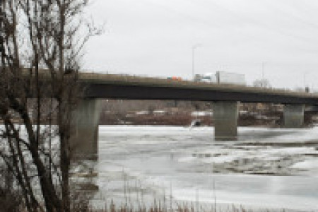
Well, we did it to ourselves. Potholes are symptomatic of a deeper issue Winnipeg has struggled to address: our dependency on automobiles. The car has shaped the way we live and experience most parts of the city. We glide past it on the way to somewhere else. This dependency is due to the physical design and layout of Winnipeg.
Not only has the way we designed the city shaped the way we move, but the way we move has shaped the city in return. That shape is unfortunately defined by sunken potholes, broken or frozen water-main pipes and brown tap water.
It’s time to have a conversation about how Winnipeg got here, and examine how this city has been shaped over the last several decades.
***
Winnipeg was a boomtown in the early twentieth century. Between 1891-1921, the city’s population exploded from 25,000 to 180,000. We quickly became the largest city on the prairies, and the fastest growing city in North America. Our turn of the century architecture in the Exchange District reflects the early affluence of Winnipeg’s forefathers. Yet despite being a relatively slow growth centre since the 1960s, the allure of the “big city” never went away. It seems there is a persistent desire for Winnipeg to be a boomtown again; a major metropolitan city.
Unfortunately, the result of this optimism has caused Winnipeg to sprawl. The city has more than doubled its footprint since 1961, while the population has only grown approximately one third. The Manitoba Legislative Building (450 Broadway), for instance, was designed to hold representatives for a province of two million, the number of residents forecasted to populate the city by the year 2000.
Of course, Winnipeg isn’t alone in this approach to city building. Most North American cities sprawled in the post-war period. Between 1961 and 2006, Winnipeg doubled in size physically. While the city grew, the population, and retail spaces, migrated outward to the suburbs, and the roads – a key part of the problem – stretched out with them. The result was an emptying out of the inner city, culminating in a downtown where the single largest use of land is parking lots.
The most significant impact this type of development has had is regarding people’s transportation choices. That’s because most of these new areas are mono-functional landscapes, where often the only real choice you have is to drive, because nothing is within walking distance. People will drive to the library, to the gym and to school, because it’s the easiest route. Neighbourhood design already made that choice for you.
“ The car has shaped the way we live and experience most parts of the city. We glide past it on the way to somewhere else. This dependency is due to the physical design and layout of Winnipeg.
Think about the neighbourhood you live in. If you had to choose a different way of getting to work, could you do it? Is it within walking or cycling distance? Is there a bus that could get you there in the time it takes to read the morning paper? Could you go to the grocery store or the pharmacy without a car? If the answer is no, then chances are your neighbourhood has been designed for a specific type of travel: by car.
Harbourview South is a pertinent example. The neighbourhood was constructed in 2006 close to the northeastern edge of the city. It’s a typical suburban development you might expect to see at the periphery of most North American cities. It’s defined by its meandering roads and numerous cul-de-sacs. Few places design travel behaviour as powerfully as neighbourhoods like Harbourview South. The enclave has huge lots with wide, curving roads. Most shops and stores are concentrated far away on Regent Avenue, surrounded by parking lots. Most people in Harbourview South can’t, and won’t, walk to a nearby shop or business.
Nothing influences travel behaviour more than the iconic cul-de-sac. When developers try to maximize the number of cul-de-sacs in an area, they create a system of roads that makes just about every destination farther away because it eliminates the most direct routes between places. When you observe Harbourview South from an aerial view, you’ll notice it has a tree-like system of cul-de-sacs that feed all the traffic into a few main collector streets, or branches. The collector streets funnel traffic to the two major arterials, Concordia Ave. and Grassie Blvd. In Harbourview South, land uses are neatly segregated, with shops and homes located far away from each other.
Architect Jan Gehl pointed out years ago that neighbourhoods designed for one mode of transportation, such as private automobiles, will cause the roads to fill up with people using that mode of transportation. That’s certainly been the case in Winnipeg.
***
Most people in Winnipeg simply do not walk because we have designed destinations out of walking reach. Before moving to a central walkable neighbourhood, this writer lived near the northwestern edge of the city, in a suburb called Amber Trails. There, the developer didn’t even build a sidewalk on some streets. If you do an Internet search for the nearest grocery store from my previous residence, you’ll be faced with a warning one would normally expect in a third world town: “Use caution: may involve sections not suited for walking”.
Compare this type of development to the traditional grid street layout found in older neighbourhoods like Osborne Village. For residents there, the grocery store, the pharmacy, a bar or a bus stop is never more than a few blocks away. People who live in these types of neighbourhoods drive 26 per cent fewer kilometers than people in the cul-de-sac neighbourhoods, and they’re likely to weigh at least ten pounds less than their suburban counterparts.
On average there are about 35 traffic collisions in Winnipeg each day. Of these, one out of five result in a serious injury or fatality. Meanwhile, more car-oriented developments continue to be approved by city council, adding more drivers to the roads. Just recently, a developer building on a 30 hectare site at the southwest corner of Jefferson Ave. and King Edward St. fought to prevent a bus route from running through the subdivision. At least 15 similar subdivisions have either been approved, or are underway in the past few years.
Suburban development at the fringes continues despite the very well documented negative externalities they have on our bodies, our health and our cities. They encourage less walking and more driving, which has two immediate impacts on the conditions of our roads.
First, as more development is constructed on the fringes, there is an increase in driving, leading to more congestion, longer commutes, and much more stress on the roads. Second, new subdivisions come with many new roads, and sometimes sidewalks, that the City (meaning the taxpayer) has to maintain. All neighbourhoods need services like snow removal, park maintenance and garbage pick-up. With increasing costs, all of this growth has stretched the budget thinner, leaving less room for regular infrastructure improvements (i.e maintaining the roads and pipes we’ve got) and more reliance on higher levels of government for help.
Despite these known adverse effects, new car-only development continues to be approved for the city’s periphery. And accordingly, more is demanded from the city, and by extension, the taxpayer (a note to renters: your landlord pays property taxes too, they are just added to your rent). The streets continue to be put under stress, and the associated costs continue to climb.
Our elected officials in City Hall don’t like to make unpopular decisions, like charging taxpayers more to cover the costs of new subdivisions. So far they haven’t been able to articulate that infrastructure costs money, and we can’t have new infrastructure without paying for it. This means that the budget cannot be stretched, given the number of taxpayers we have, without increasing taxes.
Recently, the idea of charging a growth-development fee for new subdivisions has been floating around – which would certainly be a step in the right direction – and most major cities in North America have this fee in place to cover the costs that new development incurs to the city.
It’s also interesting to note that new developments are called "subdivisions" instead of "neighbourhoods". That’s because these neighbourhoods are really just the subdivision of land for development and profit. It has nothing to do with city building and creating complete communities. That really tells us a lot about the places we inhabit.
The pothole problem doesn’t exist in isolation, it exists within the context of a city that has poorly managed its growth over the past several decades. Just trying to fix the potholes is akin to a doctor treating a patient's symptoms, rather than the disease.
But the tide is shifting. Such developments as So/Po, the ALT hotel, and Glasshouse condos are underway in downtown Winnipeg. Transit-oriented infill development is happening at the Fort Rouge yards, which will bring that under-populated neighbourhood back to population levels closer to the 1970s. The Exchange District’s population also continues to slowly grow, and families are moving into the Waterfront neighbourhood. Cycling is also becoming popular; Winnipeg even hosted the annual Winter Cycling Congress this past February.
It did take us 40 years to get to where we are now, and it might take another 40 for us to solve these problems. No one likes potholes, or brown tap water, or frozen pipes. But to address these problems, we need to critically examine how our city is being shaped. It will need to begin with a reasonable discussion about how we want to live in this city. The more we choose to drive, the more our city gets shaped to accommodate drivers. Do we want more driving and longer commutes, or do we want vibrant streets and walkable neighbourhoods?
Rak Singh is a graduate student in the city planning program at the University of Manitoba.
Part of the series: The Urban Issue 2014